
Polperro Postscripts
A blog for anyone with an interest in Polperro, publishing and people... with occasional musings on history and humanity.
Subscribe
Recent Posts
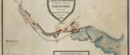
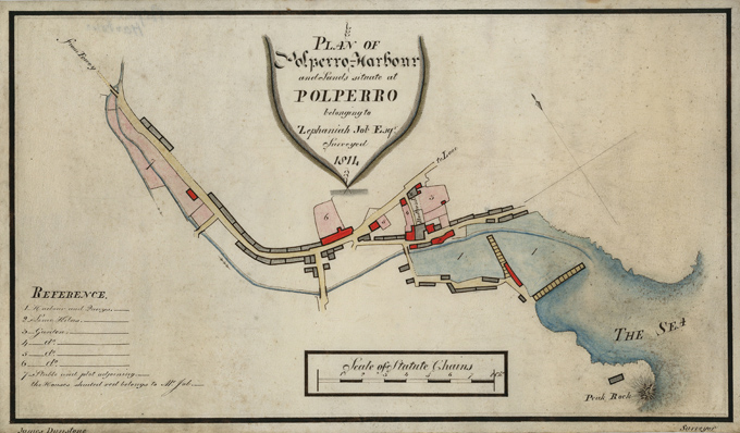
Last autumn I was contacted by a lady living near Truro, saying she had come across an ‘antique’ map while clearing her late aunt’s house relating to properties owned by Zephaniah Job in Polperro. When I visited her, she produced the map, dated 1814 and described as a ‘Plan of Polperro Harbour and lands situate at Polperro belonging to Zephaniah job Esq. Surveyed 1814’. It was drawn on calf skin vellum and had obviously been kept rolled up for some considerable time.
The map, drawn by surveyor James Dunstone, shows a number of properties leading down from the Coombes to the harbour where the quays and limekilns were marked. Properties coloured red were shown as belonging ‘to Mr Job’ and included the buildings on the inner quay; several along The Warren overlooking the inner harbour, including the lime kilns; others on Talland Hill along with their gardens; another in Fore Street with a large garden, and a stable and plot of land on the west side of the Coombes.
It was almost certainly drawn for Zephaniah Job, the ‘Smugglers’ Banker’, following the sale of the Raphael Manor estate on the west side of Polperro in 1813 when many of the tenants, including Job, were able to buy their homes. Job himself paid £630 for seventeen properties in Polperro, including the sand quay, the two lime kilns on The Warren, the slip where coal, goods and merchandise were landed and even the harbour itself:
‘... all that the Haven or Harbour of Polperro extending from the sea at low water mark up the Beach to the Street called Lansallos Street as far as high water mark together also with the two Piers or Quay walls standing in the said harbour and the mooring rings and mooring places .... also all the Rock at the entrance of the said harbour called the Peak which is the sole defence of the said Harbour and Quay Walls in stormy weather .... and also a right is hereby given and granted to and for the said Zephaniah Job his heirs and assigns his workmen and labourers to dig search for and take stones wanting and sufficient for the reparation and rebuilding of the said Piers and Quay Walls from the path leading from Jane Mark’s house by Chapel House to the Peak Rock.’
The harbour proved to be Job's one bad investment. In January 1817, just four years after he bought it, Polperro was hit by a storm of such terrible severity that it destroyed almost everything in the harbour. It was a devastating blow for Job who at once set about having all the damage repaired at enormous cost to himself. The effort of repairing the damage left by the storm took its toll on him. Although nearly 70 years old, his banking and commercial activities still demanded a great deal of his attention and, exhausted by the strain of rebuilding Polperro's shattered economy, his health began to suffer.
For the last few years of his life Zephaniah Job lived in a cottage at Kellow near Crumplehorn Mill in the coombe above Polperro. During his final illness he was treated by Dr Jonathan Couch until his death at the age of 73 on the last day of January 1822.
The 1814 map showing the properties and land he owned is believed to be the oldest known plan of Polperro. It has now undergone conservation by a Harrogate based restorer; professionally cleaned, flattened and framed, it will be displayed in the Polperro Museum.